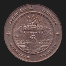
Thai.
Name of a province (map)
and its capital city in Central Thailand, 219 kms north of
Bangkok on the West bank of the
Sakae Krang river, a tributary to the Chao Phraya. The city has a population of
approximately 30,000 with a large community of
Karen.
In the northwest of the city is a mountain named Khao Sakae Krang (เขาสะแกกรัง).
At the
bottom of the mountain is the
wihaan
of Wat Sangkat Rattana Khiri (วัดสังกัสรัตนคีรี), that houses a
gilded
Buddha image
known as Phra Phuttha Mongkhon Saksit (พระพุทธมงคลศักดิ์สิทธิ์).
The image dates from the
Sukhothai
period and was cast in the reign of
the
14th century
King
Mahadhammaracha Lithai
(fig.).
Opposite of the wihaan is a
long
naga-staircase
with 449 steps that that leads to the
summit of Khao Sakae Krang (fig.),
which offers a
bird's-eye view of the city,
and has a
mondop that
houses a
Buddhapada, as
well as a
large bronze bell that hangs in front of the mondop and which was
built in the reign of King
Rama V.
It is
said that this bell is sacred and that visitors to the province who
have not rung it have not truly seen the province. Also at the
summit is a pavilion with a large statue of
Somdet
Phra
Pathom
Borom
Maha
Chanoknaht, i.e.
the Royal Father
of King
Rama I,
who was born in
the
Ayutthaya period
as
Thongdi
at Ban Sakae Krang in the
Sakae Krang River basin in the old city of
Uthai Thani. The mountain's
name akin to the old name
of this region, i.e.
Meuang Sakae Krang.
Uthai Thani is known for its unspoiled nature, such as
Hup Pah Tahd (map
-
fig.), and Khao Sakae Krang, a mountain
range between the Huai Yai River in the North and the Khlong Yai River in the
South.
Huai Kha Khaeng
is a Wildlife Sanctuary and a World Heritage Site that
borders
Tak
Province, covers an area of 2,574
kmē, and is home to a large
variety of animals, including
tigers
and
elephants. The province has eight
amphur,
and the provincial flower is that of the
Silk Cotton Tree
(fig.),
which grow abundantly on Mount
Sakae Krang.
See also
Uthai Thani data file.
回


