|
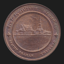
Samut Prakan (สมุทรปราการ)
Thai. ‘Fortress
at Sea’. Name of a
province (map)
and its capital city in the region of central Thailand, 29 kms south
of the centre of
Bangkok. The
most densely populated provincial capital of Thailand with
approximately 72,000 inhabitants on an area of approximately just
1,004 square kms and bordering Bangkok. Generally known as Meuang
Pahk Nahm, the city at the estuary because of its location at the
mouth of the
Chao Phya
river (fig.),
near the
Gulf of Thailand,
a place with many sandbanks and bars called
sandon
(fig.).
Places of interest include the
Phra
Chulachomklao
fortress dating from 1893 and built near the river mouth as a
defensive outpost for Bangkok (fig.),
and Phra Samut Chedi, a
chedi whose construction
started during the rule of King
Phra Phutta Leut La
and ended in the period of King
Phra Nang Klao.
Today it is situated on the banks of the Chao Phraya river (map
-
fig.),
but at the time it stood in the middle of the river on a small
island. Hence its name Phra Chedi Klang Nahm (chedi in the middle of
the water). At the Chulachomklao navy-yard on the West bank near the
Gulf of Thailand,
stands a statue of King Chulachomklao (map
-
fig.)
and is a naval museum, consisting of a large battle ship (map
-
fig.)
and a garden with naval armaments (map
-
fig.).
There is also the
Naval Museum
in the
amphur
meuang
(fig.),
the
Erawan Museum (map
-
fig.),
Samut Prakan
Crocodile Farm
and Zoo (map
-
fig.),
the Old Pahk Nahm Prison Towers (fig.),
the
City Observation Tower (fig.),
Bang Poo Nature Reserve (fig.),
Phra Thutangkha Chedi (fig.),
and
Meuang Boraan,
an open-air museum (fig.)
consisting of a contrived village (meuang) with statues, traditional
houses and sights from Thai antiquity (boraan). The province has
five
amphur
and one
king amphur.
See also
Samut Prakan data file.
回


|