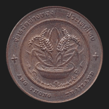
|
Angthong (อ่างทอง)
Thai.
‘Gold basin’. Name of both a town and a province (map)
in Central Thailand. The province covers an area of 968.3 km² and the town has
around 10,000 inhabitants. The town is situated on the banks of the
Chao Phrya river, around 108 km from
Bangkok and the province borders to
Singburi in
the North, to
Lopburi in the East, to
Ayutthaya in the Southeast
and to
Suphanburi in the West. The province is a low
river flat consisting of mostly agricultural land. Besides the Chao Phraya
river, the province is also crossed by the Noi river and both are used
extensively for farming
rice. It was
formerly called Meaung Wiset Chai Chahn and Meuang Bang Kaew. Initially located
on the banks of the Noi River, it formed an important border town of the kingdom
of Ayutthaya during
its age-long wars with Burma, as the Noi river served as a natural obstacle for
advancing Burmese troops. During the reign of king
Taksin, after the fall of Ayutthaya in 1767,
the main city of the province was moved to the Chao Phraya river, as the Noi
river had become too shallow for transportation. It was renamed Angthong,
referring to the golden colour of the rice grown in the region, as well as to
its basin-like geography. Angthong is said to be the hometown of Nai Dok and Nai
Thongkaew, two heroes from
Bang Rajan,
and of
the Mitchai family, a famous family of
likae actors,
singers and songwriters. The main occupation of its inhabitants is paddy and
crop farming, fishing and cattle breeding, basket and drum making, trade and
industry. The province has many
persimmon trees and its chief rivers are the
Noi and Chao Phraya. Its
places of interest include Wat Chaiyo
Worawihaan and Wat Pah Mohk Worawihaan. Angthong province has seven
amphur, 81
tambon
and 513
mu ban.
Often transcribed Ang Thong. See also
Angthong data file and
Moo Koh Angthong for the National Marine Park.
回


|

